BALTIMORE — An Extreme Heat Warning is in effect today from 10 AM to 8 PM, with temperatures expected to reach the low 100s. The heat index, factoring in humidity, will make it feel as high as 113 degrees.
As the day progresses, isolated thunderstorms may develop, bringing the risk of damaging wind gusts and heavy rainfall. Residents are encouraged to remain cautious and limit time spent outdoors during peak heat hours.
Looking ahead to Saturday, the oppressive heat will persist, with highs again nearing 100 degrees and heat index values possibly reaching 108. Thunderstorms are more likely on Saturday, some of which could be severe, with wind gusts potentially hitting 70 mph and heavy rain that could cause localized flooding, particularly in urban areas.
For those planning outdoor activities over the holiday weekend, staying informed about weather conditions is crucial.
Forecast Overview
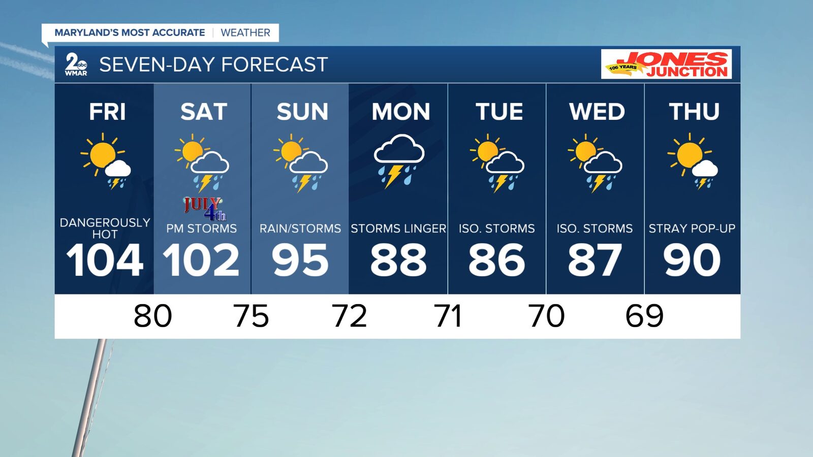
- Today: Sunny and hot, high near 104, heat index up to 113.
- Tonight: Mostly clear, low around 80.
- Independence Day: Hot with a chance of showers and thunderstorms, high near 102, heat index up to 110.
- Saturday Night: Mostly cloudy, low around 75 with a chance of showers.
- Sunday: Partly sunny, slight chance of showers, high near 95.
- Monday: Mostly cloudy, high near 88 with a chance of showers.
Reported by HarborBeat based on WMAR-2 News (source).
0 Comments
Log in to join the conversation.