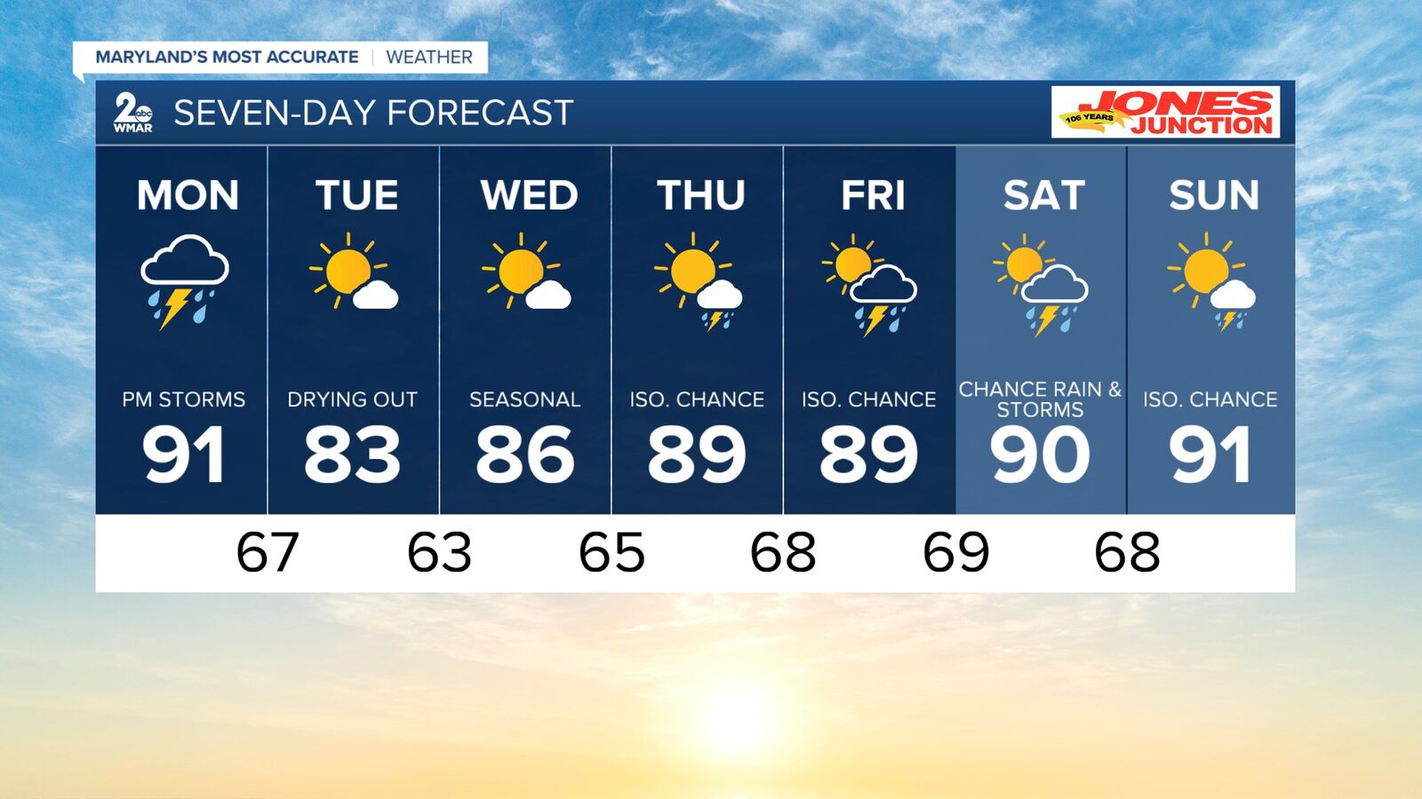
BALTIMORE — As the work week begins, Baltimore residents can expect strong to severe thunderstorms, particularly between 1 PM and 8 PM today. The National Weather Service has indicated that temperatures will reach the low 90s, creating conditions conducive to severe weather.
The primary threats associated with today's storms include large hail, damaging winds, localized flooding, and the possibility of isolated tornadoes. Winds are anticipated to gust up to 24 mph, shifting from southeast to south throughout the afternoon.
Following today's severe weather, conditions are expected to improve. Tuesday will bring mostly sunny skies with a high around 83 degrees, and nighttime lows will drop to approximately 63 degrees. Wednesday will continue the trend with sunny weather and temperatures reaching near 86 degrees.
Looking ahead, there is a chance of isolated storms later in the week, particularly Thursday through the weekend. Highs will remain in the upper 80s to low 90s, with overnight lows ranging from the mid-60s to upper 60s.
Residents are advised to stay informed about the weather and take necessary precautions during the stormy conditions expected today.
Reported by HarborBeat based on WMAR-2 News (source).
0 Comments
Log in to join the conversation.